RSMeans Data Online
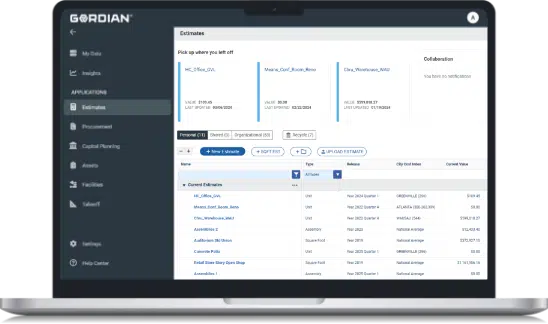
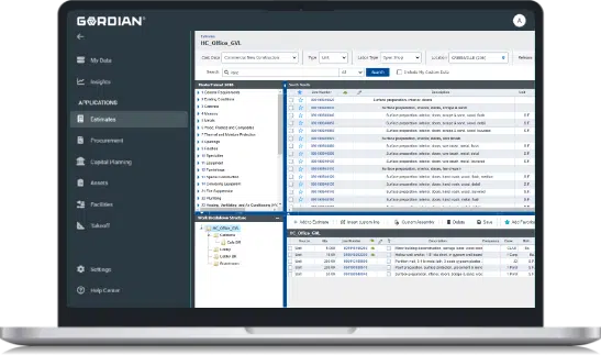
Access the most accurate, up-to-date construction cost data found anywhere at the click of a button. Available in three tiers, RSMeans Data Online was designed to serve the varying needs of every organization. Enjoy precision in cost estimating with automatic quarterly updates and detailed price breakdowns.
Take a Tour Now

Using the RSMeans Data Online system works so much better than the books. I can get so many more estimates done more quickly and accurately.”
Frank Yonke | Estimator and RSMeans Data Online User
Plan Your Next Project With the Most Up-to-Date Cost Data Available
RSMeans Data Online offers construction professionals timely and reliable cost data for every kind of project imaginable. With access to over 92,000-unit line items, including equipment, material and labor prices, users can plan budgets with the utmost precision.


Estimate With Continuously Validated, Localized Prices
Each year, Gordian cost researchers spend over 30,000 hours ensuring that all costs listed within RSMeans™ Data are accurate. Rather than compiling average pricing, the team goes a step further in guaranteeing location-specific figures for over 970 locations across North America.
Explore Three Convenient Tiers of Service:

RSMeans Data Online
Core
The Core tier of RSMeans Data Online provides reliable construction cost data along with the tools necessary to quickly access costs at the material or task level. Users can create unit line estimates with RSMeans Data from Gordian and share them with ease.

RSMeans Data Online
Complete
The Complete tier of RSMeans Data Online is designed to provide the latest in construction costs with comprehensive tools for projects of varying scopes. Unit, assembly or square foot price data is available 24/7 from the web-based application.

RSMeans Data Online
Complete Plus
The Complete Plus tier was developed to take project planning and estimating to the next level with the most advanced set of construction costing tools in the industry. This includes access to our full catalog of historical construction costs and the ability to predict material price changes up to three years into the future.

RSMeans Data is accepted as an impartial industry standard for construction costs. As such, I reference it during construction cost reviews.”
Ronald Semel
Cost Reviewer | State of Virginia Department of General Services
Key Features Include:

- Access to Over 92,000 Unit Line Items
- Estimate in Detail or at a Conceptual Level
- Pricing for 970+ Locations Across North America
- 30,000+ Hours of Research Per Year
- One Comprehensive Database
Includes material, labor and equipment pricing.
Quickly add, edit and share your price proposals. Plus, enjoy a variety of advanced estimating tools at each tier level, including square foot estimators and a life cycle costing estimator.
Guarantees area relevance and specificity with every estimate.
Eliminates the need for time-consuming, manual price research.
Enjoy 24/7 access to all of your estimates, tools and more in one secure location.
What to Expect From RSMeans Data Online

Reliability
RSMeans Data Online provides reliable construction cost data and tools for detailed and conceptual estimates.

Accuracy
Users can expect accurate pricing, comprehensive data coverage and support for maintaining project schedules.

Convenience
The platform is designed to streamline project management and ensure efficiency in construction planning and execution.


